ICAR-National Bureau of Soil Survey & Land Use Planning (NBSS&LUP) has recently entered into a Memorandum of Understanding (MoU) with the Jharkhand State Watershed Mission (JSWM), Government of Jharkhand, for the "Land Resource Inventory of Three Selected Watersheds, Jharkhand" project. This initiative, part of the Pradhan Mantri Krishi Sinchai Yojana 2.0 (PMKSY 2.0), focuses on advanced land use planning using geospatial techniques.
The MoU aims to inventorize, characterize, and map the land, soil, and water resources in the Ranchi, Khunti, and Deoghar districts. The project seeks to generate comprehensive information and detailed maps of these resources in the selected watersheds, thereby supporting land resource management and planning. The Jharkhand State Watershed Mission backs this initiative, highlighting its commitment to sustainable development and effective resource management.
The Land Resource Inventory (LRI) approach will facilitate the creation of land evaluation and site-specific management strategies. These strategies are designed to aid planners and stakeholders in developing suitable land use models that ensure sustainability and enhance ecosystem profitability. The detailed information and maps produced through this project will be instrumental in decision-making processes related to land use planning and resource management.
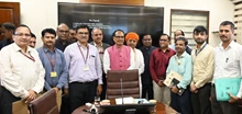
The signing ceremony was attended by notable figures, including Awadh Narayan Prasad, Joint Secretary, Department of Rural Development, Dr. Lakhan Lal Mahato, State GIS Expert, JSWM, N. K. Mishra, State Technical Expert, JSWM, and other officials from the Rural Development department of Jharkhand. Their presence underscores the importance of this collaboration in advancing the state's rural development goals through scientific and geospatial methodologies.
This partnership between ICAR-NBSS&LUP and JSWM marks a significant step towards sustainable land resource management in Jharkhand, promising long-term benefits for the environment and the local communities.


